RTK vs. PPK Drone Mapping: What's the Difference?
Did you know that there are positioning methods that can help GPS systems be more accurate in drone surveys? This is RTK (Real Time Kinematics) and PPK (Post-Processing Kinematics) technology.
Commercial drones rely on GPS units and compasses. However, the accuracy of these devices can vary depending on weather conditions, terrain, device quality, or other factors. Even under ideal conditions, standard GPS systems provide meter-level accuracy.
To achieve higher precision, technologies like RTK and PPK are used. These systems correct common errors in GNSS (Global Navigation Satellite Systems), significantly improving the accuracy of survey data collected by drones.
Curious about how RTK works? Want to understand the difference between RTK and PPK? Continue reading to discover how each can benefit your projects.
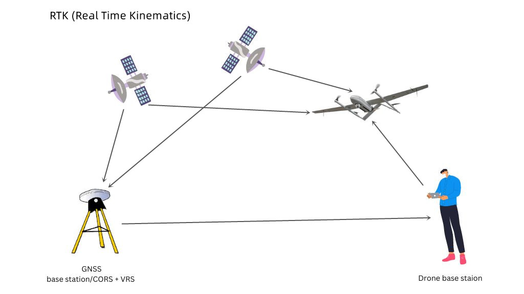
How does an RTK drone work?
RTK drones have onboard GNSS receivers that collect satellite data while flying. A ground-based base station at a known location provides real-time corrections for precise position tracking.
Seamless communication between the drone and the base station is essential during the flight.
Once the drone lands, the collected data can be processed in mapping software to generate highly accurate results.
RTK works best in open areas within 2–3 km of a base station or 30 km of a CORS network. If you have your own base station, it can be used with an RTK drone as long as it can generate NTRIP data.
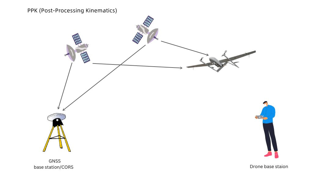
What is PPK in drones and how does it work?
PPK (Post-Processing Kinematics) is a positioning method where GPS data is corrected after the flight, not in real time.
Both the base station and rover record raw GNSS data, which is later processed to apply corrections.
What can you do with RTK drones?
RTK GPS drones are used in various applications to make things easier and more efficient. Here are four common uses:
Public safety
RTK drones assist law enforcement and emergency services by providing real-time, accurate location data. They can track missing persons, monitor disaster zones, and enhance firefighter safety.

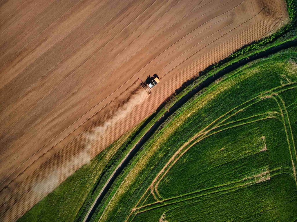
Agriculture
RTK drones help farmers map vegetation, plan irrigation, and guide autonomous machinery. They enable precise crop management and resource optimization.
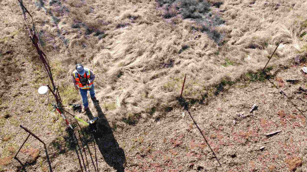
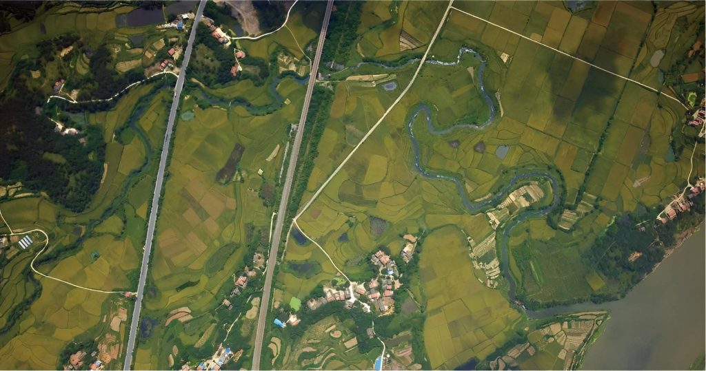
Surveying/mapping
RTK drones are essential for land mapping, capturing GPS data and geotagging images during flights. They allow safe and accurate mapping of remote or difficult-to-reach areas.
Inspection
RTK drones improve remote inspections by providing real-time, precise location data. This helps identify potential defects in infrastructure, ensuring safer and more efficient maintenance operations.
Best RTK drones for sale
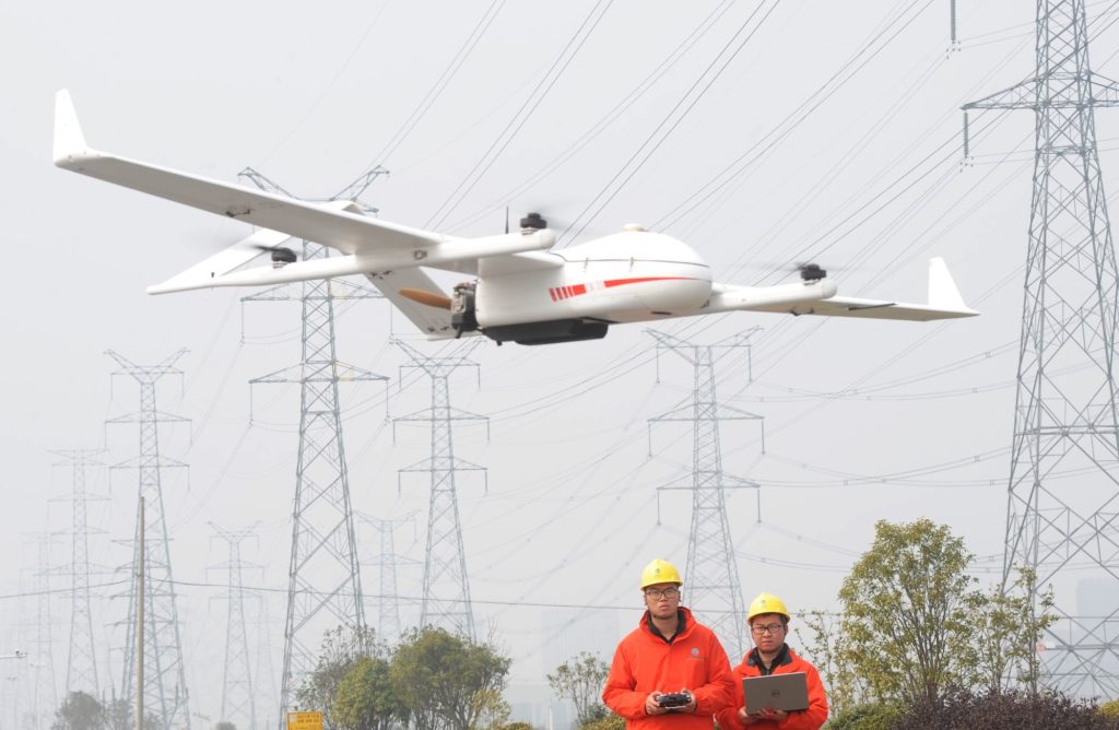
The JOUAV CW Series VTOL drones are among the best for surveying, combining RTK and PPK for high accuracy. They offer up to 1 cm absolute accuracy and GSD down to 5-8mm per pixel.
These fixed-wing drones are designed for vertical takeoff and landing. They can operate in confined spaces and cover large areas with up to 600 minutes of flight time and 10kg payload capacity.
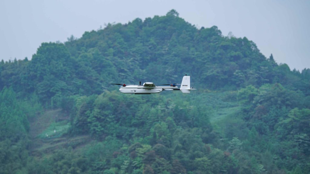
JOUAV CW-007
Lightweight and portable, the CW-007 can be operated by one person. With a modular design, it can be assembled in two minutes. It covers 6 km² with 5 cm/px GSD and has a 55-minute flight time.
JOUAV CW-15
Designed for aerial surveying, the CW-15 offers 180-minute flight time and 61km/h cruising speed. It supports multiple payloads and features a 61MP full-frame camera for high-accuracy image metadata.
Recycling FIBC bulk bags, jumbo bags, and PP ton bags is an important step towards reducing waste and preserving our environment. These bags are commonly used for transporting and storing bulk materials such as grains, chemicals, and construction materials.
Recycle Fibc Bulk Bags,Fibc Bulk Bags Recycling,Big Recycle Fibc Bulk Bags,Recycle Fibc Bags
Zhejiang Changying Plastic Packaging Products Co., Ltd. , https://www.cyfibc.com